I think you might be interested in this track:
https://maps.google.com/maps/ms?msa=0&msid=211884999970758800308.0004ca6d8a775e1a2488c
Created by My Tracks on Android.
Name: 23/09/2012 1:22pm
Activity type: -
Description: -
Total distance: 2.53 km (1.6 mi)
Total time: 1:26:13
Moving time: 39:24
Average speed: 1.76 km/h (1.1 mi/h)
Average moving speed: 3.86 km/h (2.4 mi/h)
Max speed: 13.10 km/h (8.1 mi/h)
Average pace: 34.03 min/km (54.8 min/mi)
Average moving pace: 15.55 min/km (25.0 min/mi)
Fastest pace: 4.58 min/km (7.4 min/mile)
Max elevation: 382 m (1252 ft)
Min elevation: 309 m (1013 ft)
Elevation gain: 158 m (520 ft)
Max grade: 0 %
Min grade: 0 %
Recorded: 23/09/2012 1:22pm
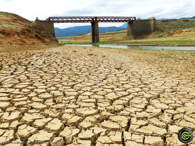
The old Teldeniya town is now visible becasue of the drought. It's situated few Kms ahead from Teldeniya bus stand. I started my journey alone from kandy. I could take the bus from kandy to Teldeniya. Journey was about 40 minutes. I was asking the route from an achchi and the conductor also helped me to find.
When I stepped into that place I felt like that im in Africa. Because it's a vast area with a barren field.
I will upload my photos in my blog to watch you too.
View 23/09/2012 1:22pm in a larger map
 |
| Theldeniya Old Town's Bridge. The floor it cracked due to drought . |

No comments:
Post a Comment